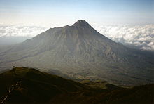
Kinabalu mountain

Posted: Senin, 01 Oktober 2012 by Afif 'Davit' Afriza in Label: , , , , , , , , ,
0

Mount Kinabalu (Malay: Gunung Kinabalu) is a prominent mountain on the island of Borneo in Southeast Asia. It is located in the East Malaysian state of Sabah and is protected as Kinabalu National Park, a World Heritage Site. Kinabalu is the highest peak in Borneo's Crocker Range and is the highest mountain in the Malay Archipelago. Mount Kinabalu is also the 20th most prominent mountain in the world by topographic prominence.
In 1997, a re-survey using satellite technology established its summit (known as Low’s Peak) height at 4,095 metres (13,435 ft) above sea level, which is some 6 metres (20 ft) less than the previously thought and hitherto published figure of 4,101 metres (13,455 ft).
Mount Kinabalu includes the Kinabalu montane alpine meadows ecoregion in the montane grasslands and shrublands biome. The mountain and its surroundings are among the most important biological sites in the world, with over 4500 species of plant, 326 species of birds, and 100 mammalian species identified. Among this rich collection of wildlife are famous species such as the gigantic Rafflesia plants and the orangutan. Mount Kinabalu has been accorded UNESCO World Heritage status.
Low's Peak can be climbed quite easily by a person in good physical condition and there is no need for mountaineering equipment at any point on the main route. Other peaks along the massif, however, require rock climbing skills.

Contents

Biology

Significantly, Mount Kinabalu along with other upland areas of the Crocker Range is well-known worldwide for its tremendous botanical and biological species biodiversity with plants of Himalayan, Australasian, and Indomalayan origin. A recent botanical survey of the mountain estimated a staggering 5,000 to 6,000 plant species (excluding mosses and liverworts but including ferns),[3][6][7][8][9][10] which is more than all of Europe and North America (excluding tropical regions of Mexico) combined. It is therefore one of the world's most important biological sites.

Flora

The flora covers the mountain in zones of different types of habitat as one climbs up, beginning with a lowland belt of fig trees and insectivorous pitcher plants. Then between 2,600 to 3,200 m (8,530 to 10,499 ft) is a layer of short trees such the conifer Dacrydium gibbsiae and dwarf shrubs, mosses, lichens, liverworts, and ferns. Finally many of the world's richest variety of orchids are found on the high rockier slopes.
Large lower pitcher of Nepenthes rajah
These plants have high levels of endemism (i.e. species which are found only within Kinabalu Park and are not found anywhere else in the world). The orchids are the best-known example with over 800 species including some of the highly-valued Paphiopedilum slipper orchids, but there are also over 600 species of ferns (more than the whole of Africa’s 500 species) of which 50 are found nowhere else, and the richest collection in the world for the Nepenthes pitcher plants (five of the thirteen are found nowhere else on earth) which reach spectacular proportions (the largest-pitchered in the world being the endemic Nepenthes rajah).[3][11][12] The parasitic Rafflesia plant, which has the largest single flower in the world, is also found in Kinabalu (particularly Rafflesia keithii whose flower grows to 94 centimetres (37 in) in diameter),though it should be noted that blooms of the flower are rare and difficult to find. Meanwhile another Rafflesia species, Rafflesia tengku-adlinii, can be found on the neighbouring Mount Trus Madi and the nearby Maliau Basin.
Its incredible biodiversity in plant life is due to a combination of several unique factors: its setting in one of the richest plant regions of the world (the tropical biogeographical region known as western Malesia which comprises the island of Sumatra, the Malay Peninsula, and the island of Borneo), the fact that the mountain covers a wide climatic range from near sea level to freezing ground conditions near the summit, the jagged terrain and diversity of rocks and soils, the high levels of rainfall (averaging about 2,700 millimetres (110 in) a year at park HQ), and the climatic instability caused by periods of glaciation and catastrophic droughts which result in evolution and speciation. This diversity is greatest in the lowland regions (consisting of lowland dipterocarp forests, so called because the tree family Dipterocarpaceae are dominant). However, most of Kinabalu’s endemic species are found in the mountain forests, particularly on ultramafic soils (i.e. soils which are low in phosphates and high in iron and metals poisonous to many plants; this high toxic content gave rise to the development of distinctive plant species found nowhere else).

Fauna
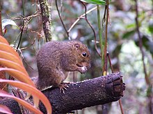
A mountain squirrel, probably Sundasciurus tenuis, from Mount Kinabalu
The variety of plant life is also habitat for a great variety of birds and animals. There are some 326 species of birds in Kinabalu Park, including the spectacular Rhinoceros Hornbill, Mountain Serpent-eagle, Dulit Frogmouth, Eyebrowed Jungle Flycatcher, and Bare-headed Laughingthrush. Twenty-four birds are mainly found on the mountain and one, the Bornean Spiderhunter, is a pure endemic. The mountain is home to some 100 mammalian species mostly living high in th trees, including one of the four great apes, the orangutan (though sightings of these are uncommon; estimates of its numbers in the park range from 25 to 120). Other mammals include three kinds of deer, the Malayan Weasel (Mustela nudipes), Oriental Small-clawed Otter (Aonyx cinerea), and Leopard Cat (Felis bengalensis). Endemic mammals include the Black Shrew (Suncus ater) and Bornean Ferret-badger (Melogale everetti).
Endemic annelids number less than a dozen known species but include the Kinabalu giant red leech that preys on various earthworms, including the Kinabalu giant earthworm.

Threats and preservation

The steep mountainsides with poor soil are not suitable for farming or for the timber industry so the habitats and animal life of Kinabalu remain largely intact, with about a third of the original habitat now degraded. Kinabalu Park was established in 1964 and the nearby mountains were protected as the Crocker Range National Park in 1984. However even national park status does not guarantee full protection, as logging permits were granted on Trus Madi in 1984.

Geology

Summit of Mount Kinabalu
Mount Kinabalu is essentially a massive pluton formed from granodiorite which is intrusive into sedimentary and ultrabasic rocks, and forms the central part, or core, of the Kinabalu massif. The granodiorite is intrusive into strongly folded strata, probably of Eocene to Miocene age, and associated ultrabasic and basic igneous rocks. It was pushed up from the earth’s crust as molten rock millions of years ago. In geological terms, it is a very young mountain as the granodiorite cooled and hardened only about 10 million years ago. The present landform is considered to be a mid-Pliocene peneplain, arched and deeply dissected, through which the Kinabalu granodiorite body has risen in isostatic adjustment. It is still pushing up at the rate of 5 mm per annum. During the Pleistocene Epoch of about 100,000 years ago, the massive mountain was covered by huge sheets of ice and glaciers which flowed down its slopes, scouring its surface in the process and creating the 1,800-metre (5,900 ft) deep Low's Gully (named after Hugh Low) on its north side. Its granite composition and the glacial formative processes are readily apparent when viewing its craggy rocky peaks.

History

British colonial administrator Hugh Low made the first recorded ascent of Mount Kinabalu's summit plateau in March 1851. Low did not scale the mountain's highest peak, however, considering it "inaccessible to any but winged animals". In April and July 1858, Low was accompanied on two further ascents by Spenser St. John, the British Consul in Brunei. The highest point of Mount Kinabalu was finally reached in 1888 by zoologist John Whitehead. British botanist Lilian Gibbs became the first woman and the first botanist to summit Mount Kinabalu in February 1910.
Botanist E. J. H. Corner led two important expeditions of the Royal Society of Great Britain to the mountain in 1961 and 1964. Kinabalu National Park was established in 1964. The park was designated a natural World Heritage Site in 2000.

Climbing route

Mount Kinabalu climbing trail at lower elevations (left) and on the summit plateau (right)
Climbers must be accompanied by accredited guides at all times due to national park regulations. There are two main starting points for the climb: the Timpohon Gate (located 5.5 km from Kinabalu Park Headquarters, at an altitude of 1,866 metres (6,122 ft)),and the Mesilau Nature Resort. The latter starting point is slightly higher in elevation, but crosses a ridge, adding about two kilometres to the ascent and making the total elevation gain slightly higher. The two trails meet about two kilometres before Laban Rata.
Accommodation is available inside the park or outside near the headquarters. Sabah Parks has privatized Mount Kinabalu activities to an organization called Sutera Sanctuary Lodges (also known as Sutera Harbour). The mountain may be climbed on a single day trip, or hikers may (usually) stay one night at Laban Rata Resthouse at 3,270 metres (10,730 ft) in order to complete the climb in 2 days, finishing the ascent and descending on the second day. The majority of climbers begin the ascent on day one of a two day hike from Timpohon gate at 1,866 metres (6,122 ft), reaching this location either by minibus or by walking, and then walk to Laban Rata. Most people accomplish this part of the climb in 3 to 6 hours. Since there are no roads, the supplies for the Laban Rata Resthouse are carried by porters, who bring up to 30 kilograms of supplies on their backs. Hot food and beverages are available at Laban Rata, but there is no hot water in the bathrooms and whilst the dining area is heated, the rooms are not. The last 2 kilometres (6,600 ft), from the Laban Rata Resthouse at 3,270 metres (10,730 ft) to Low's Peak (summit) at 4,095.2 metres (13,436 ft), takes between 2 and 4 hours. The last part of the climb is on naked granite rock.
Given the high altitude, some people may suffer from altitude sickness and should return immediately to the bottom of the mountain, as breathing and any further movement becomes increasingly difficult.[18]

Low's gully

Low's Gully (named after Hugh Low) is a 1,800-metre (5,900 ft) deep gorge on the north side of Mount Kinabalu, one of the least explored and most inhospitable places on earth. In 1994 two British Army officers were severely criticised after having led a party of 10 adventurers that required extensive rescue efforts from both the RAF and the Malaysian army. Five members of the party were trapped for 16 days and did not eat for five days before being rescued. The breakaway party of five successfully completed the world's first descent of the gully in three days.

Tales

"Kina Balu from Pinokok Valley" - lithograph published in 1862
A visual illusion of a rock face on Mt. Kinabalu. Caught on camera from a location in Mesilau, December 2011.
There are two stories that led to the main beliefs in the origin of the mountain's name.
The first derivation of the word Kinabalu is extracted from the short form for the Kadazan Dusun word 'Aki Nabalu', meaning "the revered place of the dead".
The second source states that the name "Kinabalu" actually means "Cina Balu" (which would fully mean "A Chinese Widow"). Due to the lingual influence among the Kadazan Dusun of Sabah, the pronunciation for the word "cina" (chee-na) was changed to "Kina" (kee-na).
It was told that a Chinese prince, was cast away to Borneo when his ship sank in the middle of the South China Sea. He was subsequently rescued by the natives from a nearby village. As he recovered, he was slowly accepted as one of the people of the village. Eventually, he fell in love with a local woman, and married her. Years went by, and he started to feel homesick. So he asked permission from his newly-found family to go back to China to visit his parents (the Emperor and Empress of China). To his wife, he promised that as soon as he was done with his family duties in China, he would come back to Borneo to take her and their children back to China.
When he made his return to China, he was given a grand welcome by his family. However, to his dismay, his parents disagreed with him about taking his Bornean wife back to China. Worse, they told him that he was already betrothed to a princess of a neighbouring kingdom. Having no choice (due to high respect towards his parents), he obeyed with a heavy heart.
Meanwhile, back in Borneo, his wife grew more and more anxious. Eventually, she decided that she will wait for her husband's ship. However, since the village was situated far away from the coast, she couldn't afford to come to the shore and wait for him daily. Instead she decided to climb to the top of the highest mountain near her village, so that she could have a better view of the ships sailing in the South China Sea. Thus, she was then seen climbing up the mountain at every sunrise, returning only at night to attend to her growing children.
Eventually her efforts took their toll. She fell ill, and died at the top of the cold mountain while waiting for her husband. The spirit of the mountain, having observed her for years, was extremely touched by her loyalty towards her husband. Out of admiration for this woman, the spirit of the mountain turned her into a stone. Her face was made to face the South China Sea, so that she could wait forever for her dear husband's return.
The people in her hometown who heard about this were also gravely touched by this. Thus, they decided to name the mountain "Kinabalu" in remembrance of her. To them, the mountain is a symbol of the everlasting love and loyalty that should be taken as a good example by women.
Local legend among the people of Ranau, a district in Sabah, has it that St. John's Peak was the stone which her body was turned into.

Gede Mountain

Posted: by Afif 'Davit' Afriza in Label: , , , , , ,
0

Mount Gede Pangrango National Park is a national park in West Java, Indonesia. The park is centred on two volcanoes—Mount Gede and Mount Pangrango— and is 150 km² in area.
It evolved from already existing conservation areas, such as Cibodas Botanical Gardens, Cimungkat Nature Reseve, Situgunung Recreational Park and Mount Gede Pangrango Nature Reserve, and has been the site of important biological and conservation research over the last century. In 1977 UNESCO declared it part of the World Network of Biosphere Reserves.


Topography and ecology


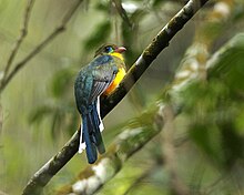
The Javan Trogon found in the national park, is an endangered species endemic to West Java
Mount Gede (2,958 m) and Pangrango (3,019 m) are twin volcanoes. The two summits are connected by a high saddle known as Kandang Badak (2,400 m). The mountain slopes are very steep and are cut into rapidly flowing stream, which carve deep valleys and long ridges.
Lower and upper montane and subalpine forests are within the park and have been well studied. To the north of Mount Gede is a field of Javanese Edelweiss (Anaphalis javanica). The park contains a large number of species known to occur only within its boundaries, however, this may be a result of the disproportionate amount of research over many years.

Flora and fauna

Gunung Gede-Pangrango is inhabited by 251 of the 450 bird species found in Java. Among these are endangered species like the Javan Hawk-eagle and the Javan Scops Owl.
Among the endangered mammal species in the Park there are several primates such as the Silvery Gibbon, Javan Surili and Javan Lutung. Other mammals include Leopard, Leopard Cat, Indian Muntjac, Java Mouse-deer, Dhole, Malayan Porcupine, Sunda Stink Badger, and Yellow-throated Marten.

Tourism

Visitors usually enter the park by one of the four gates of the park: the Cibodas, Gunung Putri, and Selabintana gates, all give access to the peaks; the Situ Gunung gate gives entrance to a lake area set aside mainly for family-style recreation. Cibodas gate is the most popular entrance gate and is the site of the park's headquarters. From Jakarta, the area is two hours drive, usually via Cibodas Botanical Gardens.

Semeru Mountain

Posted: by Afif 'Davit' Afriza in Label: , , , ,
0

Semeru, or Mount Semeru (Indonesian: Gunung Semeru), is a volcano located in East Java, Indonesia. It is the highest mountain on the island of Java. The stratovolcano is also known as Mahameru, meaning 'The Great Mountain. The name derived from Hindu-Buddhist mythical mountain of Meru or Sumeru, the abode of gods.

Semeru
Semeru.jpg
Semeru in 1985.
Elevation 3,676 m (12,060 ft)
Prominence 3,676 m (12,060 ft)
Ranked 44th
Listing Ultra
Ribu
Location
Semeru is located in Java Topography
Semeru
Java, Indonesia
Coordinates 8°6′28.8″S 112°55′12.0″ECoordinates: 8°6′28.8″S 112°55′12.0″E
Geology
Type Stratovolcano
Last eruption 2012 (continuing)
Climbing
First ascent Unknown
Easiest route Hike


Geology

Known also as Mahameru the (Great Mountain), it is very steep rising abruptly above the coastal plains of eastern Java. Maars containing crater lakes have formed along a line through the summit of the volcano. It was formed south of the overlapping Ajek-ajek and Jambagan calderas. Semeru lies at the south end of the Tengger Volcanic Complex.

Eruptive history

Semeru's eruptive history is extensive. Since 1818, at least 55 eruptions have been recorded (10 of which resulted in fatalities) consisting of both lava flows and pyroclastic flows. All historical eruptions have had a VEI of 2 or 3.
Semeru has been in a state of near-constant eruption from 1967 to the present. At times, small eruptions happen every 20 minutes or so.
Semeru is regularly climbed by tourists, usually starting from the village of Ranu Pane to the north, but though non-technical it can be dangerous. Soe Hok Gie, an Indonesian political activist of the 1960s died in 1969 from inhaling poisonous gases while hiking on Mount Semeru.

Mythology

Semeru is named from Sumeru, the central world-mountain in Buddhist cosmology and by extension Hinduism. As stated in legend, it was transplanted from India; the tale is recorded in the 15th-century East Javanese work Tantu Pagelaran. It was originally placed in the western part of the island, but that caused the island to tip, so it was moved eastward. On that journey, parts kept coming off the lower rim, forming the mountains Lawu, Wilis, Kelut, Kawi, Arjuno and Welirang. The damage thus caused to the foot of the mountain caused it to shake, and the top came off and created Penanggungan as well.

Merapi Mountain

Posted: by Afif 'Davit' Afriza in Label: , , , , , , , , ,
0

Mount Merapi, Gunung Merapi (literally Fire Mountain in Indonesian/Javanese), is an active stratovolcano located on the border between Central Java and Yogyakarta, Indonesia. It is the most active volcano in Indonesia and has erupted regularly since 1548. It is located approximately 28 kilometres (17 mi) north of Yogyakarta city, and thousands of people live on the flanks of the volcano, with villages as high as 1,700 metres (5,600 ft) above sea level.


Mount Merapi
Gunung Merapi
View of summit of Merapi, 2011.jpg
Merapi, July 2011
Elevation 2,930 m (9,613 ft)[1]
Prominence 1,356 m (4,449 ft)[1]
Listing Ribu
Translation Mountain of Fire (Indonesian)
Location
Mount Merapi is located in Indonesia
Mount Merapi
Border of Central Java / Yogyakarta (Indonesia)
Coordinates 7°32′26.99″S 110°26′41.34″ECoordinates: 7°32′26.99″S 110°26′41.34″E
Geology
Type Active Stratovolcano
Age of rock 400,000 years
Last eruption 30 November 2010[2]


The name Merapi could be loosely translated as 'Mountain of Fire'. The etymology of the name came from Meru-Api; from the Javanese combined words; Meru means "mountain" refer to mythical mountain of Gods in Hinduism, and api means "fire". Smoke can be seen emerging from the mountaintop at least 300 days a year, and several eruptions have caused fatalities. Hot gas from a large explosion killed 27 people on 22 November in 1994, mostly in the town of Muntilan, west of the volcano. Another large eruption occurred in 2006, shortly before the Yogyakarta earthquake. In light of the hazards that Merapi poses to populated areas, it has been designated as one of the Decade Volcanoes.
On 25 October 2010 the Indonesian government raised the alert for Mount Merapi to its highest level and warned villagers in threatened areas to move to safer ground. People living within a 20 km (12 mi) zone were told to evacuate. Officials said about 500 volcanic earthquakes had been recorded on the mountain over the weekend of 23–24 October, and that the magma had risen to about 1 kilometre (3,300 ft) below the surface due to the seismic activity. On the afternoon of 25 October 2010 Mount Merapi erupted lava from its southern and southeastern slopes.
The mountain was still erupting on 30 November 2010 however due to lowered eruptive activity on 3 December 2010 the official alert status was reduced to level 3. The volcano is now 2930 metres high, 38 metres lower than before the 2010 eruptions.

Mythology

Merapi in 2005. The constant smoke from its summit is said to come from two sacred armourers living under the mountain.
Merapi is very important to Javanese, especially those living around its crater. As such, there are many myths and beliefs attached to Merapi.

Creation

Although most nearby villages have their own myths about the creation of Mount Merapi, they have numerous commonalities. It is believed that when the gods had just created the Earth, Java was unbalanced because of the placement of Mount Jamurdipo on the west end of the island. In order to assure balance, the gods (generally represented by Batara Guru) ordered the mountain to be moved to the centre of Java. However, two armourers, Empu Rama and Empu Permadi, were already forging a sacred keris at the site where Mount Jamurdipo was to be moved. The gods warned them that they would be moving a mountain there, and that they should leave; Empu Rama and Empu Permadi ignored that warning. In anger, the gods buried Empu Rama and Empu Permadi under Mount Jamurdipo; their spirits later became the rulers of all mystical beings in the area. In memory of them, Mount Jamurdipo was later renamed Mount Merapi, which means "fire of Rama and Permadi."

Spirit Kraton of Merapi

The Javanese believe that the Earth is not only populated by human beings, but also by spirits (makhluk halus). Villages near Merapi believe that one of the palaces (in Javanese kraton) used by the rulers of the spirit kingdom lies inside Merapi, ruled by Empu Rama and Empu Permadi. This palace is said to be a spiritual counterpart to the Yogyakarta Sultanate, complete with roads, soldiers, princes, vehicles, and domesticated animals. Besides the rulers, the palace is said to also be populated by the spirits of ancestors who died as righteous people. The spirits of these ancestors are said to live in the palace as royal servants (abdi dalem), occasionally visiting their descendants in dreams to give prophecies or warnings. "

Spirits of Merapi

To keep the volcano quiet and to appease the spirits of the mountain, the Javanese regularly bring offerings on the anniversary of the sultan of Yogyakarta's coronation. For Yogyakarta Sultanate, Merapi holds significant cosmological symbolism, because it is forming a sacred north-south axis line between Merapi peak and Southern Ocean (Indian Ocean). The sacred axis is signified by Merapi peak in the north, the Tugu monument near Yogyakarta main train station, the axis runs along Malioboro street to Northern Alun-alun (square) across Keraton Yogyakarta (sultan palace), Southern Alun-alun, all the way to Bantul and finally reach Samas and Parangkusumo beach on the estuary of Opak river and Southern Ocean. This sacred axis connected the hyangs or spirits of mountain revered since ancient times—often identified as "Mbah Petruk" by Javanese people—The Sultan of Yogyakarta as the leader of the Javanese kingdom, and Nyi Roro Kidul as the queen of the Southern Ocean, the female ocean deity revered by Javanese people and also mythical consort of Javanese kings.

Geological history

Merapi before 2007 eruption.
Merapi is the youngest in a group of volcanoes in southern Java. It is situated at a subduction zone, where the Indo-Australian Plate is subducting under the Eurasian Plate. It is one of at least 129 active volcanoes in Indonesia, part of the volcano is located in the Southeastern part of the Pacific Ring of Fire–a section of fault lines stretching from the Western Hemisphere through Japan and South East Asia.Stratigraphic analysis reveals that eruptions in the Merapi area began about 400,000 years ago, and from then until about 10,000 years ago, eruptions were typically effusive, and the out flowing lava emitted was basaltic. Since then, eruptions have become more explosive, with viscous andesitic lavas often generating lava domes. Dome collapse has often generated pyroclastic flows, and larger explosions, which have resulted in eruption columns, have also generated pyroclastic flows through column collapse.
Merapi in 1930
Typically, small eruptions occur every two to three years, and larger ones every 10–15 years or so. Notable eruptions, often causing many deaths, have occurred in 1006, 1786, 1822, 1872, and 1930—when thirteen villages were destroyed and 1400 people killed by pyroclastic flows.
A very large eruption in 1006 is claimed to have covered all of central Java with ash. The volcanic devastation is claimed to have led to the collapse of the Hindu Kingdom of Mataram; however, there is insufficient evidence from that era for this to be substantiated.

2006 eruption

 
Pyroclastic flows (2006)
In April 2006, increased seismicity at more regular intervals and a detected bulge in the volcano's cone indicated that fresh eruptions were imminent. Authorities put the volcano's neighboring villages on high alert and local residents prepared for a likely evacuation. On 19 April smoke from the crater reached a height of 400 metres (1,300 ft), compared to 75 metres (246 ft) the previous day. On 23 April, after nine surface tremors and some 156 multifaced quakes signalled movements of magma, some 600 elderly and infant residents of the slopes were evacuated.
By early May, active lava flows had begun. On 11 May, with lava flow beginning to be constant, some 17,000 people were ordered to be evacuated from the area and on 13 May, Indonesian authorities raised the alert status to the highest level, ordering the immediate evacuation of all residents on the mountain.Many villagers defied the dangers posed by the volcano and returned to their villages, fearing that their livestock and crops would be vulnerable to theft. Activity calmed by the middle of May.
On 27 May, a 6.3 magnitude earthquake struck roughly 50 km (31 mi) southwest of Merapi, killing at least 5,000 and leaving at least 200,000 people homeless in the Yogyakarta region, heightening fears that Merapi would "blow".The quake did not appear to be a long-period oscillation, a seismic disturbance class that is increasingly associated with major volcanic eruptions. A further 11,000 villagers were evacuated on 6 June as lava and superheated clouds of gas poured repeatedly down its upper slopes towards Kaliadem, a location that was located southeast of Mt. Merapi. The pyroclastic flows are known locally as "wedhus gembel" (Javanese for "shaggy goat"). There were two fatalities as the result of the eruption.

2010 eruption

Destroyed house in Cangkringan Village after the eruptions
In late October 2010 the Center for Volcanology and Geological Hazard Mitigation, Geological Agency (CVGHM), (Indonesian language—Pusat Vulkanologi & Mitigasi Bencana Geologi, Badan Geologi-PVMBG), reported that a pattern of increasing seismicity from Merapi had begun to emerge in early September.
Observers at Babadan 7 kilometres (4.3 mi) west and Kaliurang 8 kilometres (5.0 mi) south of the mountain reported hearing an avalanche on 12 September 2010. On 13 September 2010 white plumes were observed rising 800 metres (2,600 ft) above the crater. Lava dome inflation, detected since March, increased from background levels of 0.1 millimetres (0.0039 in) to 0.3 millimetres (0.012 in) per day to a rate of 11 millimetres (0.43 in) per day on 16 September. On 19 September 2010 earthquakes continued to be numerous, and the next day CVGHM raised the Alert Level to 2 (on a scale of 1–4). Lava from Mount Merapi in Central Java began flowing down the Gendol River on 23–24 October signalling the likelihood of an imminent eruption.
On 25 October 2010 the Indonesian government raised the alert for Mount Merapi to its highest level (4) and warned villagers in threatened areas to move to safer ground. People living within a 10 kilometres (6.2 mi) zone were told to evacuate. The evacuation orders affected at least 19,000 people; however, the number that complied at the time remained unclear to authorities. Officials said about 500 volcanic earthquakes had been recorded on the mountain over the weekend of 23–24 October, and that the magma had risen to about 1 kilometre (3,300 ft) below the surface due to the seismic activity
After a period of multiple eruptions considered to exceed the intensity and duration of those in 1872 on 10 November 2010 the intensity and frequency of eruptions was noticed to subside.By this time 153 people had been reported to have been killed and 320,000 were displaced. Later the eruptive activities again increased requiring a continuation of the Level 4 alert and continued provision of exclusion zones around the volcano. By 18 November the death toll had increased to 275. The toll had risen to 324 by 24 November and Syamsul Maarif, head of the National Disaster Mitigation Agency (BNPB) explained that the death toll had risen after a number of victims succumbed to severe burns and more bodies were found on the volcano’s slopes.
In the aftermath of the more intensive eruptive activities in late November Yogyakarta’s Disaster Management Agency reported that there were about 500 reported cases of eruption survivors in Sleman district suffering from minor to severe psychological problems, and about 300 cases in Magelang. By 3 December the death toll had risen to 353.
On Friday 3 December 2010 the head of the National Disaster Management Agency (BNPB), Dr. Syamsul Maarif, M. Si, accompanied by the head of the Centre for Volcanology and Geological Hazard Mitigation CVGHM (PVMBG), Dr. Surono made a joint press release at the BNPB Command Post in Yogyakarta. As of 3 December 2010, at 09.00 am, the CVGHM (PVMBG) lowered the status of Mount Merapi to the level of "Caution Alert (Level III). They clarified that with this alert level the potential of hot ash clouds and projected incandescent material remained. The Geological Agency provided several recommendations including that there would be no community activities in the disaster prone areas and proclaimed an ongoing exclusion zone of 2.5 kilometres (1.6 mi) radius.

Monitoring

Merapi Volcano 27 January 2007.
Mt Merapi viewed from the peak of Mount Merbabu
Mount Merapi is the site of a very active volcano monitoring program. Seismic monitoring began in 1924, with some of the volcano monitoring stations lasting until the present. The Babadan (northwest location), Selo (in the saddle between Merbabu and Merapi), and Plawangan monitoring stations have been updated with equipment over the decades since establishment. During the 1950s and early 1960s some of the stations were starved of equipment and funds, but after the 1970s considerable improvement occurred with the supply of new equipment. Some of the pre-1930 observation posts were destroyed by the 1930 eruption, and newer posts were re-located. Similarly after the 1994 eruption, the Plawangan post and equipment were moved into Kaliurang as a response to the threat of danger to the volcanological personnel at the higher point.
The eruption of 1930 was found to have been preceded by a large earthquake swarm. The network of 8 seismographs currently around the volcano allow volcanologists to accurately pinpoint the hypocentres of tremors and quakes.
A zone in which no quakes originate is found about 1.5 km below the summit, and is thought to be the location of the magma reservoir which feeds the eruptions.
Other measurements taken on the volcano include magnetic measurements and tilt measurements. Small changes in the local magnetic field have been found to coincide with eruptions, and tilt measurements reveal the inflation of the volcano caused when the magma chambers beneath it is filling up.
Lahars (a type of mudflow of pyroclastic material and water) are an important hazard on the mountain, and are caused by rain remobilizing pyroclastic flow deposits. Lahars can be detected seismically, as they cause a high-frequency seismic signal. Observations have found that about 50 mm of rain per hour is the threshold above which lahars are often generated.

Sabo Dam

There are about 90 units (30 percent) from the total 258 units of sand barriers (sabo) were damaged. The cost for recovery is about Rp.1 trillion ($116 million).

Sterile zone

Following the 2010 eruption, three Indonesian government departments declared a prohibited zone which nobody can permanently stay and no infrastructure is allowed in 9 villages (dusun): Palemsari, Pangukrejo, Kaliadem, Jambu, Kopeng, Petung, Kalitengah Lor, Kalitengah Kidul and Srunen, all in Cangkringan district.

National park

In 2004 an area of 6,410 hectares around Mount Merapi was established as a national park. The decision of the Ministry of Forestry to declare the park has been subsequently challenged in court by The Indonesian Forum for Environment, on grounds of lack of consultation with local residents.During the 2006 eruption of the volcano it was reported that many residents were reluctant to leave because they feared their residences would be confiscated for expanding the national park.

Museum

  • Merapi Museum Center, Kaliurang Street Kilometer 25.7, Pakem subdistrict, Sleman, Yogyakarta. A replica of Merapi's Post 2010 Eruption has been created and Indonesian student visits to the museum has increased 30 percent since the latest eruption.